
The road to Nizwa: Birkat Al Mouz, Falaj Al Khatmain, Jebel Akhdar & Diana’s Point.
Oman chapter three
Abdullah picks me up in the morning. I’ve packed an overnight bag and place it beside his in the boot of the car. We’re off to Nizwa for the night.
I had booked two tours that visit the regions in and around Nizwa, each returning to Muscat. After mapping out the itineraries I asked if I could spend the night in Nizwa rather than having to return, driving the same stretch of highway twice rather than four times. The agency told me it’s possible; I’d have to pay for the guide’s accommodations. I agreed and booked a hotel for myself. I’m excited to spend a night in another town.
We drive southwest out of the city, up into the mountains at first on a road we had traveled before and then beyond. We pass mosques (Abdullah tells me there are about 5000 in the country) and rocky landscapes. Abdullah also tells me that Oman rich in the mountains and rich in the sea. Minerals come from the mountains and fish from the sea.
After about an hour stop at a gas station for refreshments.


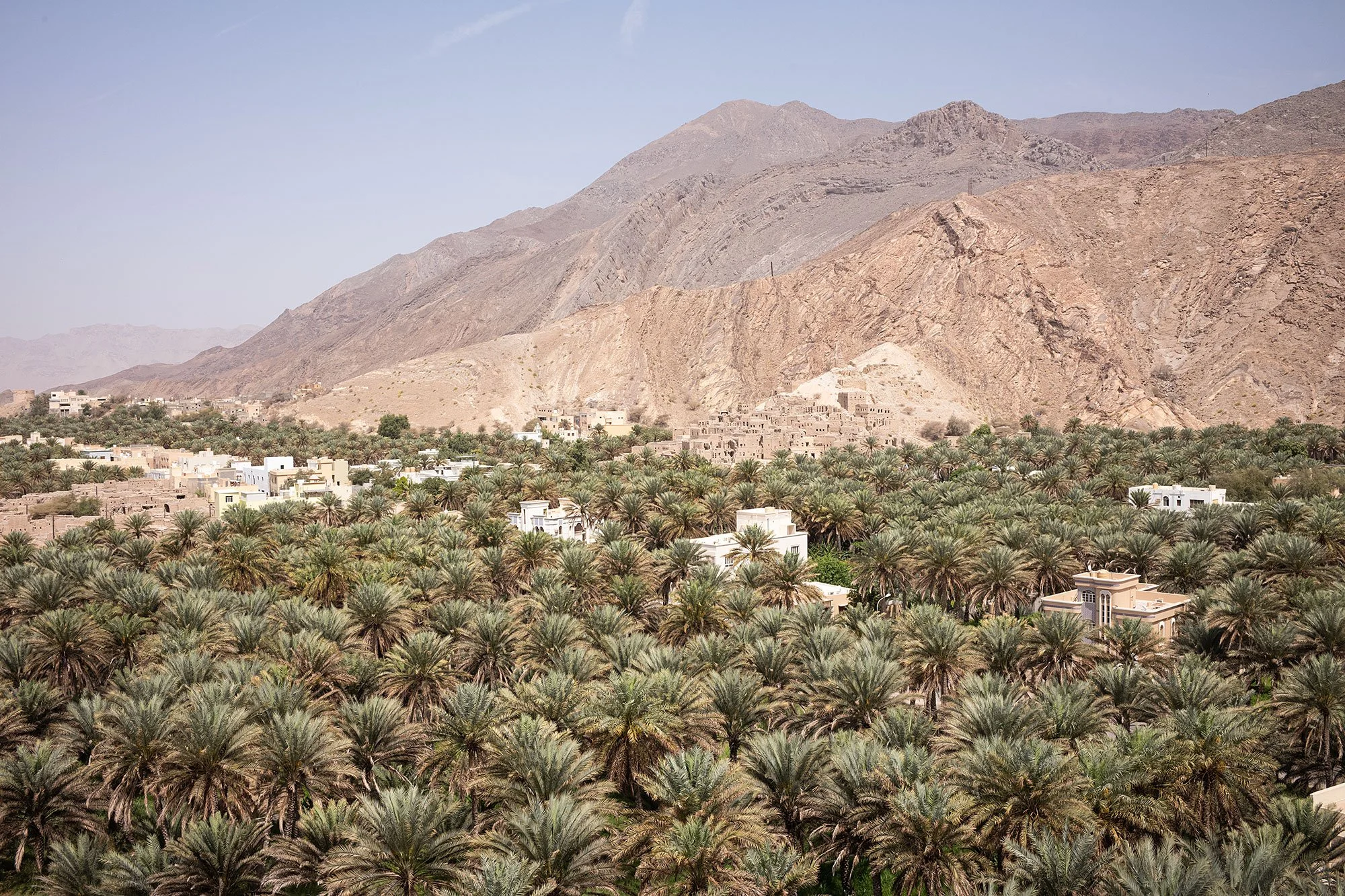
Our first stop is Birkat Al Mouz, a small village of mud-brick houses established next to an oasis. Abdullah drives up a hill so we can look out over the date palms and banana plantations towards the historic Sibani neighborhood, a ghost town rising up the mountainside.
Another car drives up soon after and three people get out to admire the same view. I introduce myself to Nassar. He’s from the Ministry of Defense and is showing two Swedish interns around the region. One of the women is originally from Sudan and speaks Arabic with Nassar. We exchange pleasantries and chat briefly before we’re each on our way. Maybe we’ll see you later, we say to each other, assuming we’ll be following the same route.

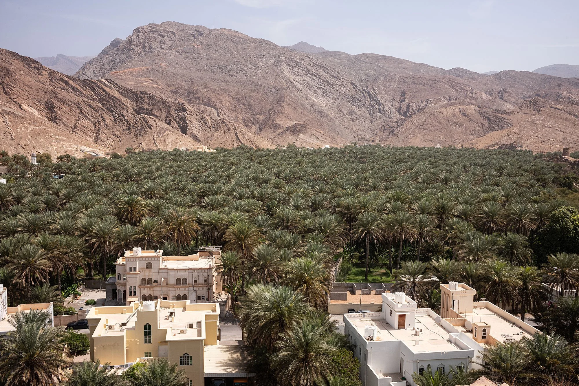
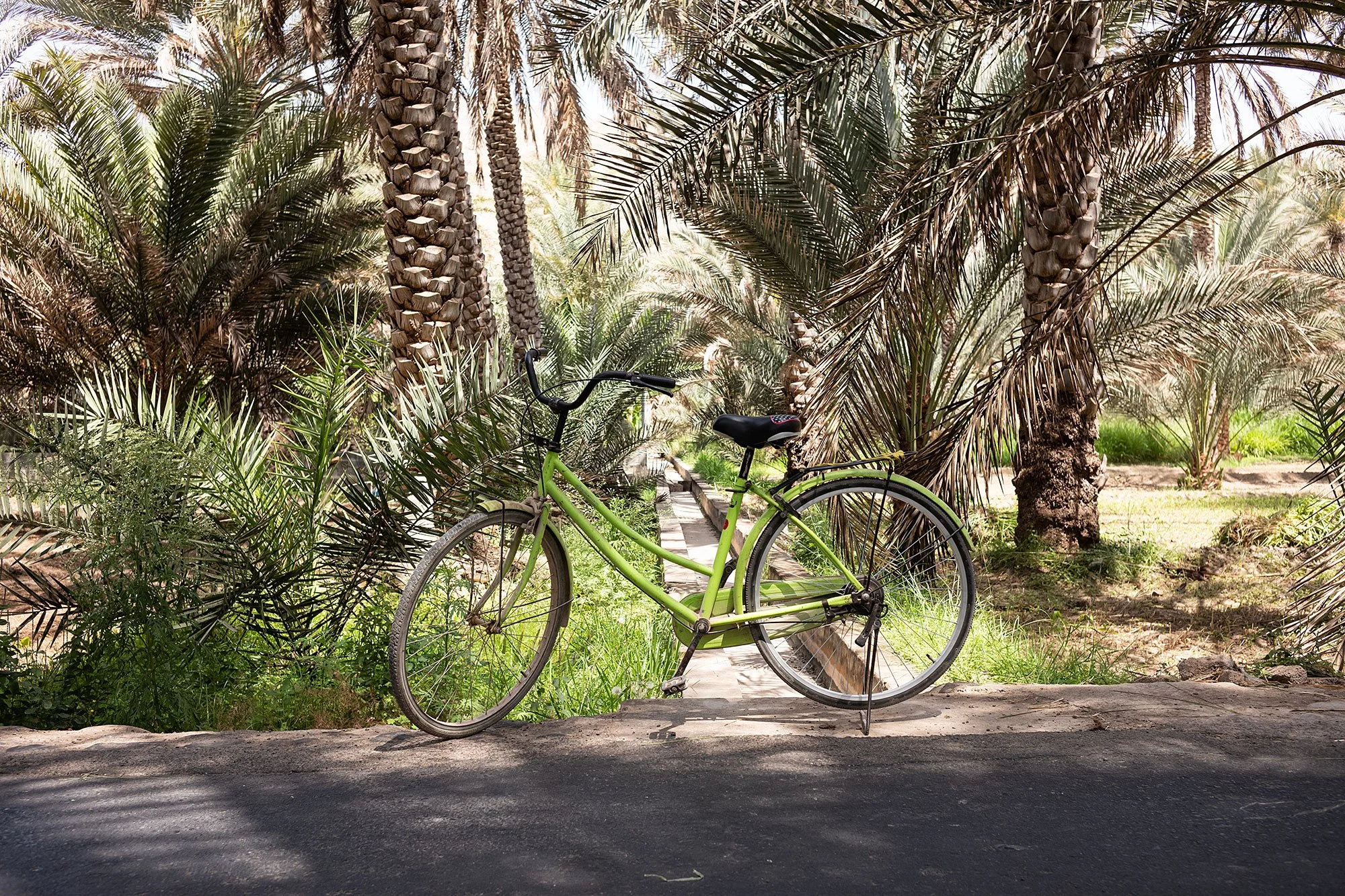
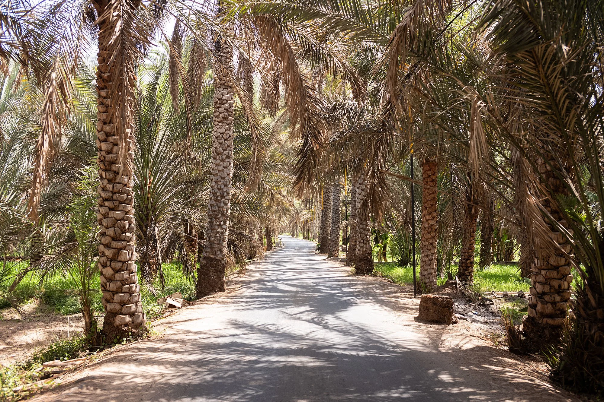
We drive down the hill and through a date palm plantation. Abdullah drops me off at one end to give me the opportunity to walk amongst the trees. He tells me he’ll pick me up on the other end of the road. It’s a tranqil spot, cool in the shade. In the distance I can see workers carrying bundles of leaves on their backs, walking paths that run along the irrigation system.

Abdullah picks me up and we drive past a glass-enclosed coffee shop that rises up over the palms. If we had the time I’d love to stop and sit and look out over the landscape, but there’s more to explore.
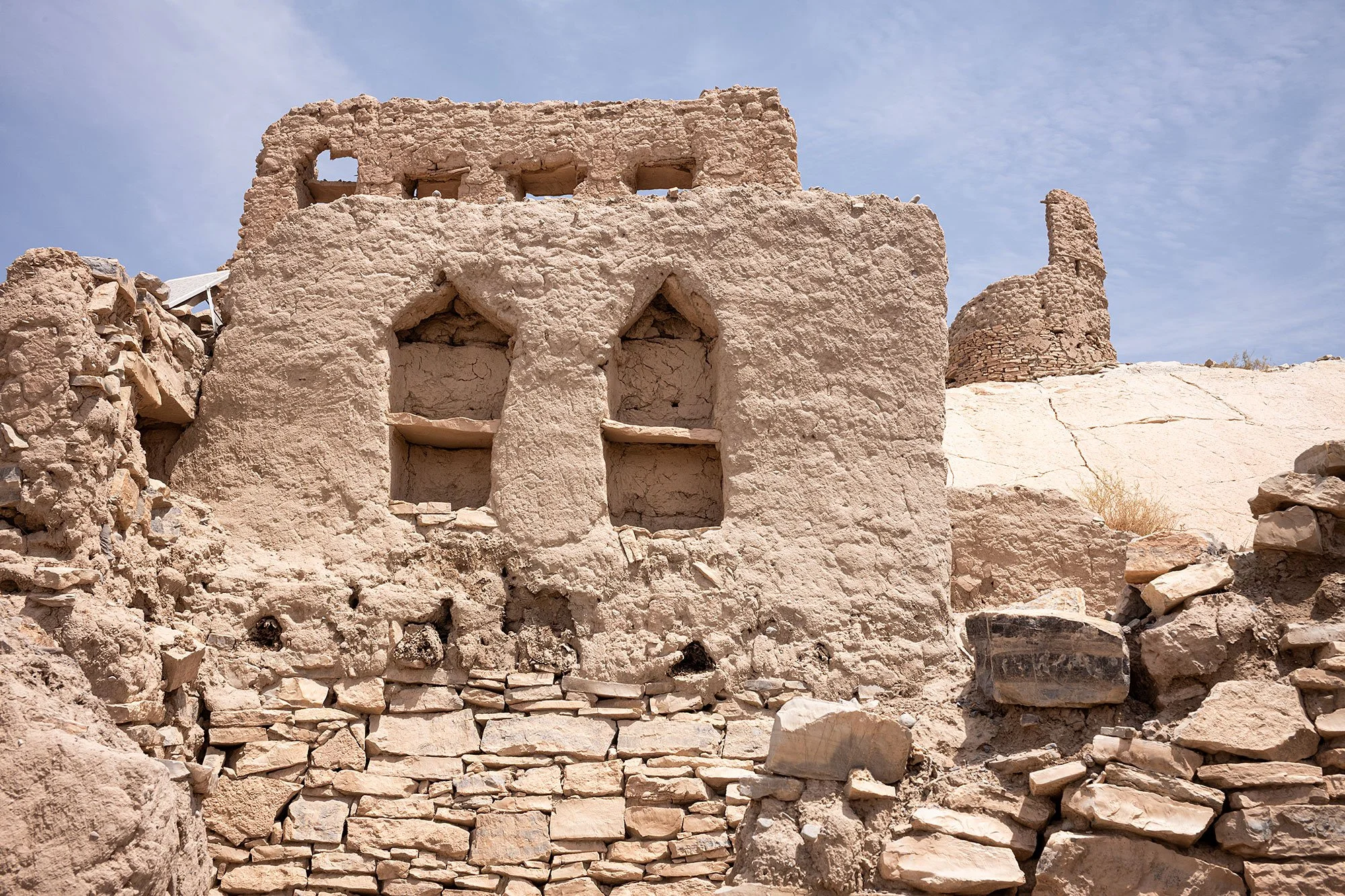
He parks a little further on at the base of the abandoned mud houses we had seen from the lookout point. Up close the ruined homes offer a glimpse into traditional Omani architecture. Abdullah leads me up a set of stairs and along an irrigation trough before leaving me to explore on my own.


I climb up through the ruins following existing paths, sometimes walking into and out of the structures, sometimes through windows or crumbled walls. I climb up as high as I can go, standing on rooftops for the view, wondering how safe the structures are, shuffling slowly across to get to the edges so that I can take photos of the palm orchards and the buildings of the new city just beyond.
Another guide leads his guests through the narrow alleyways and I stop to watch their progress, marking their location and looking up to see how the different paths separate and converge.


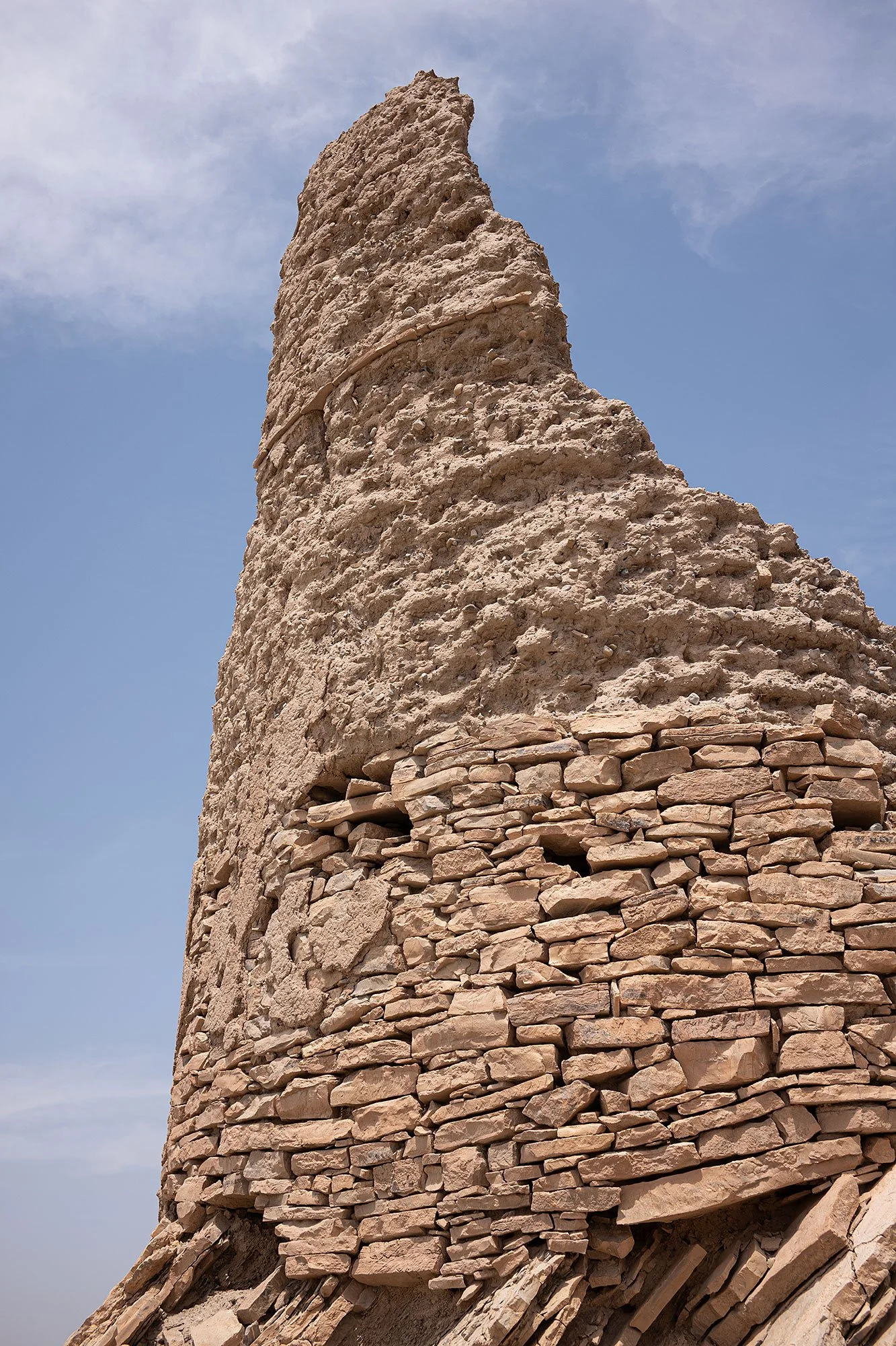
Walking to the upper edge of the village I see a crumbling round structure on the hill. There’s no obvious path up to it but I decide I must check it out and scramble over the loose rock until I reach it. Coming back down I see a couple looking looking up at the structure. They watch as I cautiously make my way down; ultimately they seem to decide not to follow in my footsteps.


Walking back down through the village I climb up onto and walk across one more rooftop before clambering down, to the foot of the village. I stop by a mosque to wash my hands before heading to the parking lot where I find Abdullah waiting for me. I slide into the passenger seat and we take off for the next stop.


We soon arrive at the Falaj Al Khatmain, a representation of a traditional irrigation and water management system that uses gravity to channel groundwater from underground sources to communities and farms. It’s fed by Wadi Al Mu’aidin and is one of five aflaj in Oman to have been listed as a UNESCO World Heritage Site.
A group of children play in the channel, bathing themselves to keep cool from the heat of the afternoon. Two men walk the aflaj before me, touring it in the same way I do, following in their footsteps.


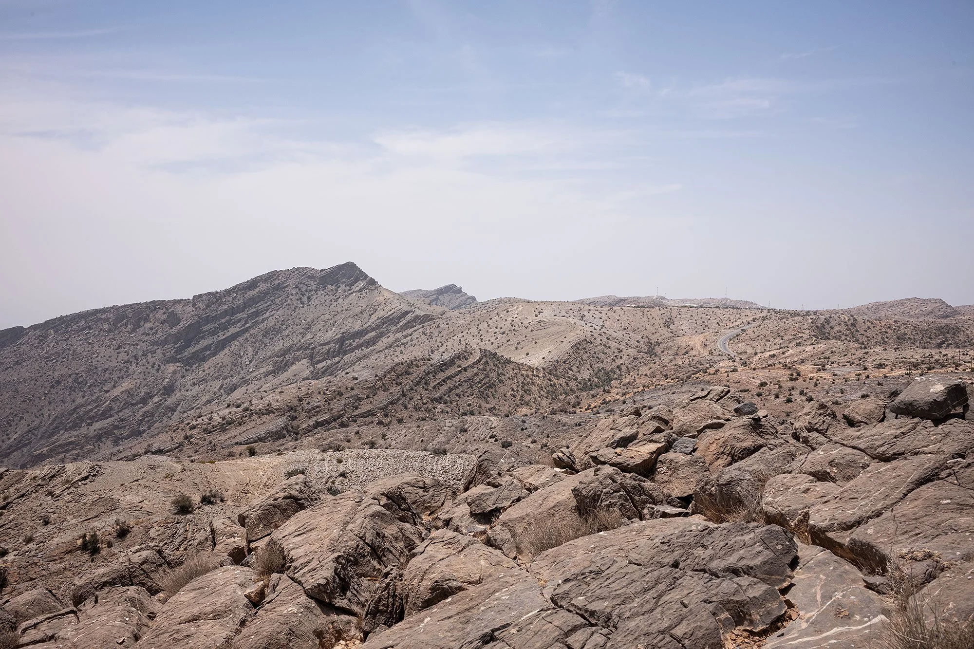
I meet Abdullah at the other end of the exposed aflaj and we continue on towards Nizwa. At one point the road starts to curve up and we reach a checkpoint after which only four-wheel-drive vehicles are allowed. And Lambourghinis. Abdullah tells me that you can pay to get a special dispensation for your car. We’re to strt climbing up to a height of 2000 meters above sea level.
I ask him to stop the car so I can take a photo. A sign tells us that we’re at 2090 meters above sea level and that from where we are standing you can see a “General Scene of Village of Wilayat Izki.”
Not quite satisfied I head up a path that leads further up the mountain to a peak from which I have sweeping views down to the valley below. It’s a beautiful spot and I’m happy to be able to pause for a moment to admire the view.


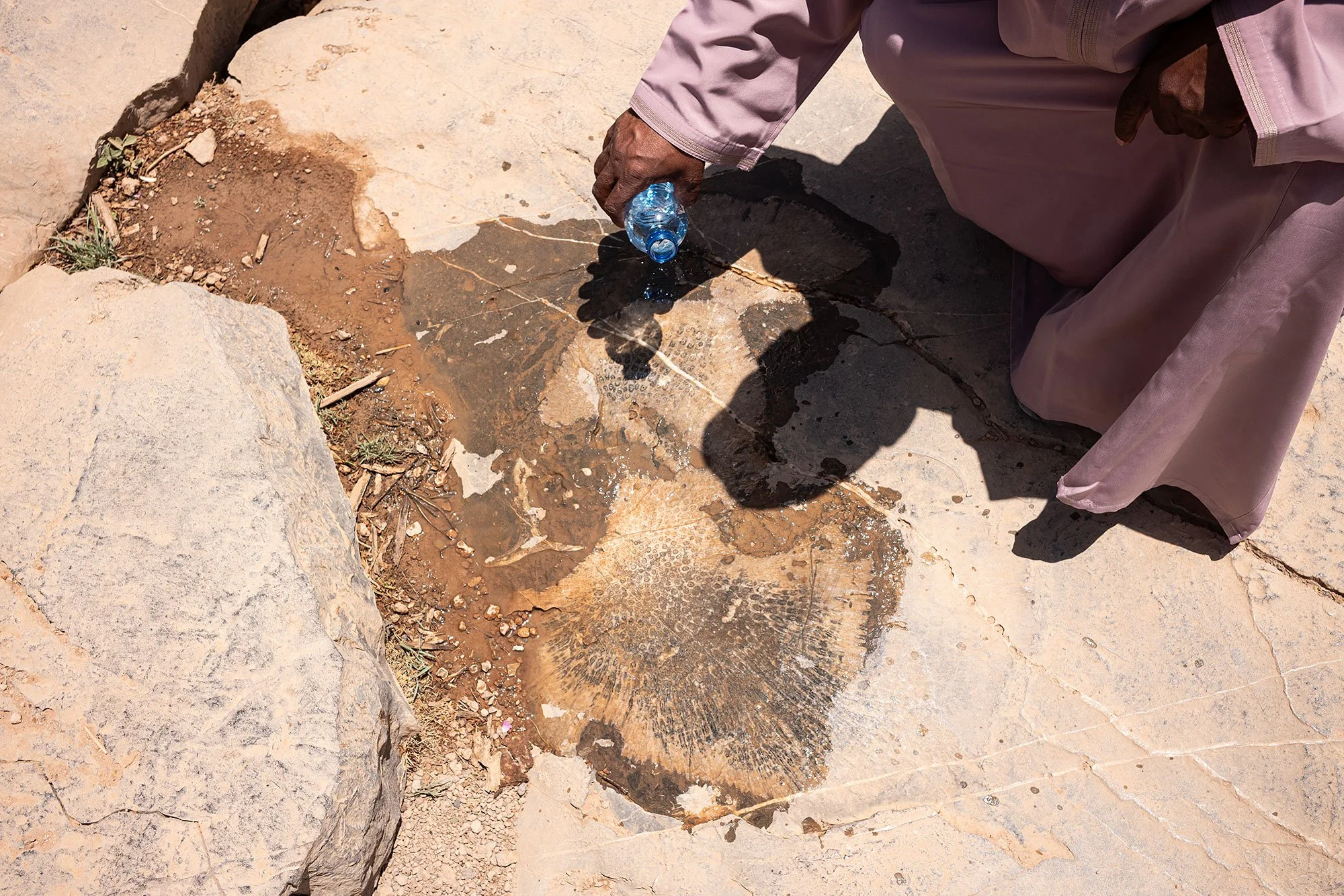
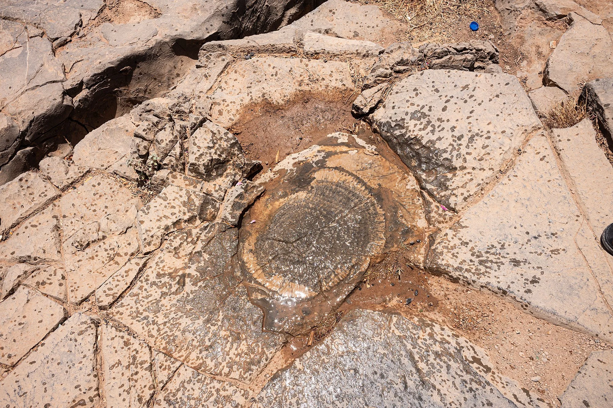
We continue into the Jabal Al Akhdar, the “Green Mountains.” Abdullah tells me that once all this land was under the sea. He stops at a viewpoint and walks me over the large rocks that make up the ground. Pausing at a certain flat stone he opens a bottle of water and splashes it over the rock at our feet. I get flashbacks to National Treasure: Book of Secrets as the fossilized shell of a turtle emerges from the stone below.
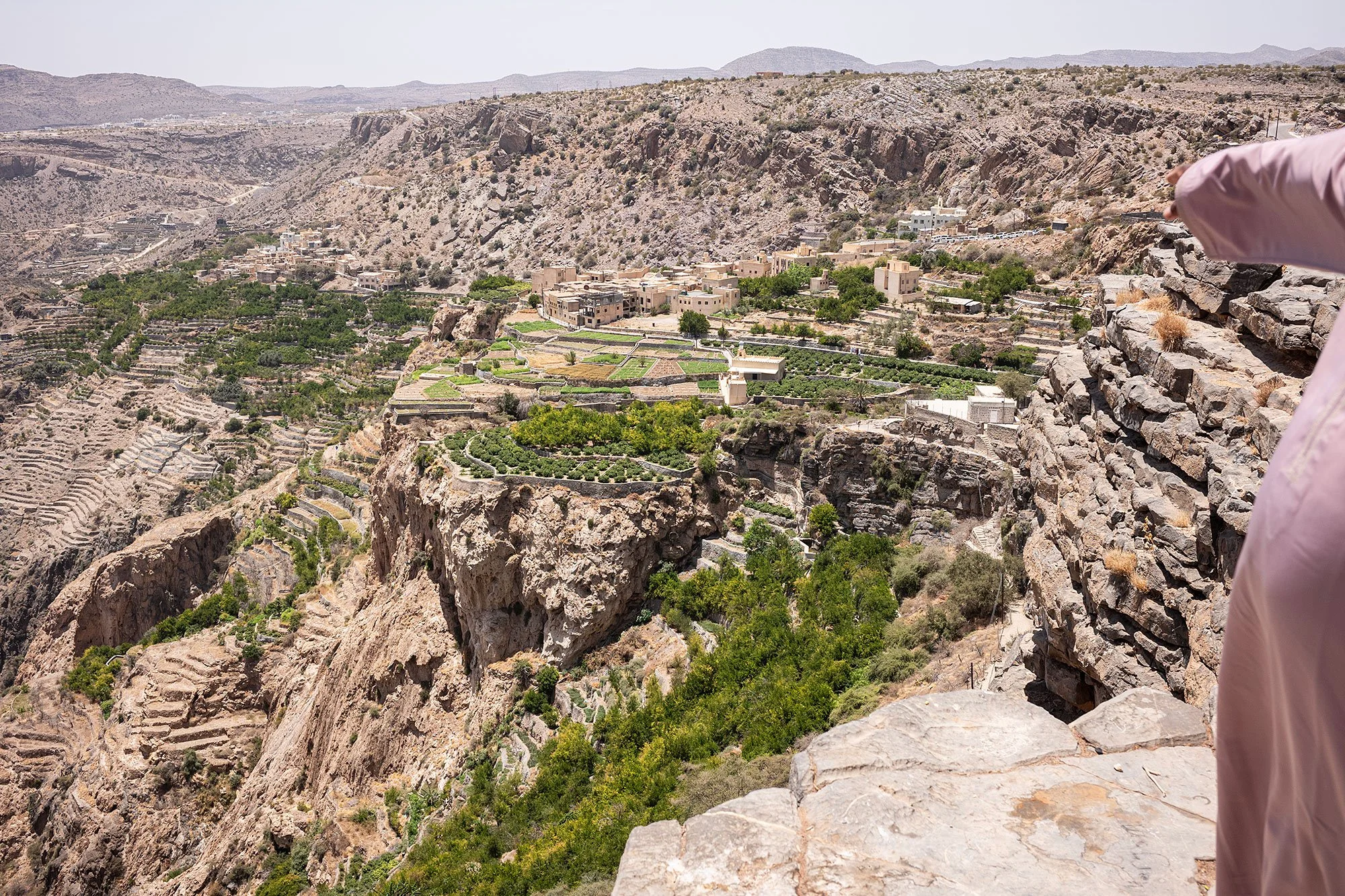
We walk along the edge of the cliff and he shows me our next stop: the village of Al Aqar. He tells me that he’ll drop me off above the village and that I can explore it myself before following the road that leads to the village of Al Ayn on the other side of the valley. A small mosque sits on the cliff surrounded by terraced orchards. He tells me he’ll wait for me there.

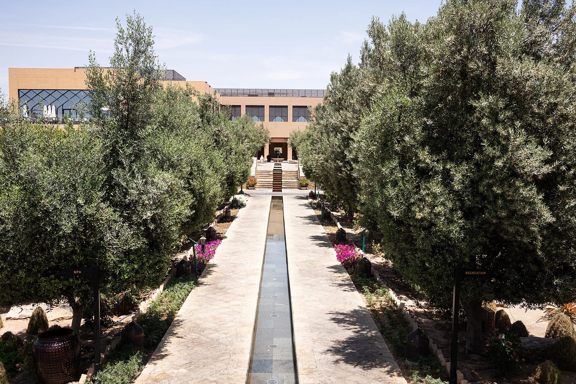
On the way to Al Aqar we pass the Anantra Hotel, a large resort that could be a hamlet unto itself. Abdullah pulls into the parking lot so that I can check it out. He tells me that Lady Diana visited with then Prince Charles in 1986 and a scenic viewpoint at the edge of the property has been named after her.
We spot women wearing shorts entering the hotel from the parking lot. Abdullah doesn’t approve, but he makes concessions. When his daughter left to study in the States he told her to respect local customs. He seems to suggest visitors to Oman do the same, but he recognizes tourism for what it is and tourists for who they are.
I walk through the hotel lobby and down a paved walkway flanking a series of pools to Diana Point. A plaque erected before the platform reads:
Diana, Princess of Wales visited this site with Prince Charles on a six hour day trip in November 1986. Their Royal Highnesses arrived by helicopter to the site that was an untouched wilderness area. Charles spent most ofhis time painting the magnificent scenery in watercolours, while Diana read a book. Tracing theirsteps, we have chosen the most idyllic viewpointito build a platform. for Diana’s Point. As you stand timelessly where Diana once was, you can imagine her there and how she must have felt sublime in the grandeur of nature.


From Diana’s Point there are unparalleled views over the gorge and orchards and surrounding villages. to the right I can see Al Ayn village, my ultimate destination. I linger over the view, joined for a moment by another couple who arrive, take a few photos, and leave.


I find Abdullah in the lobby of the hotel. Coffee and dates are available by reception and we each help ourselves to small paper cups of the former and small handfuls of the latter. We sit in the shade and sip our beverages. I’m happy for this cool oasis before we’ll once again step into the heat to visit one village and walk to the other, making note of the hotel for the future. 🇴🇲
— 26 April 2025
