A day trip to Cape Agulhas, the southern tip of Africa.

In January I took a bus up from Tunis to Bizerte in order to visit Cape Angela, the northern tip of Africa. In January of last year while in Dakar I walked from lunch to the western tip of Africa.
When my cousins invited me to meet up with them in Cape Town, I knew I’d have to take advantage of the opportunity to visit Cape Agulhas, the southern tip of Africa. The eastern tip of Africa lies in Somalia; I doubt I’ll have the opportunity to visit that in my lifetime.
I’m outside waiting for my guide with plenty of time to spare. My cousins have opted to visit Robben Island and we make plans to meet up for dinner at the waterfront when we’re each back from our respective trips. A few cars drive by and I wonder what the vehicle will be. Eventually, a sedan pulls up and the driver asks my name. I tell him and he tells me to hop in.
We pick up another couple from a hotel in the center of the city and we’re off, driving off towards the mountains outside of Cape Town.


We stop at a gas station along the way to pick up snacks for the drive. It’ll be a long day in the car; it’s almost three hours to the Cape.
We drive towards the coast to drive along the sea, stopping at Gordon’s Bay for the view. Passing through town, our guide tells us that it’s a great place to buy property. You’re not far from Cape Town and the prices are still reasonable.
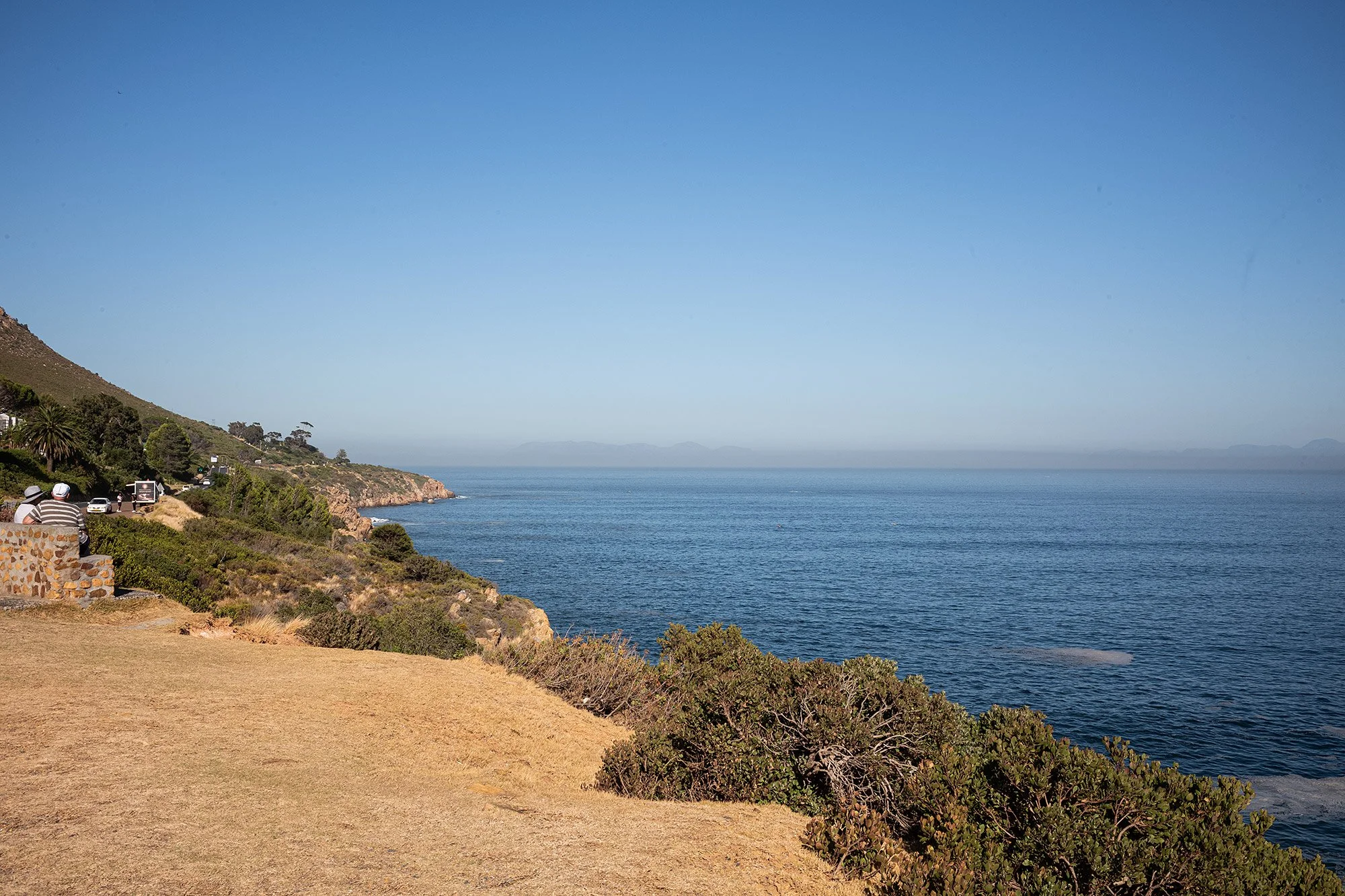


After stretching our legs a bit we climb back into the car and continue heading south along the coast. We spot a baboon on the side of the road and slow to take a look before continuing on to Pringle Bay. We stop at a lookout over the bay to admire the coastline and the waves crashing on the beach.


The road leads inland and we drive past Betty’s Bay and Kleimond fishing village without stopping. They’re building a new penguin viewing platform, but it’s not yet complete. Our guide tells us it’s also a popular whale watching area, but it’s not the season.
Our next stop is in Hermanus, another town noted for its whale watching. When I visited in 2010, I saw whales logging right off the beach. The whale crier was out then, but today I see no sight of him.
On our way we spot eland by the road and pass Benguela Cove, which our guide tells us is listed as the 86th best vineyard in the world. It’s a pity we don’t stop.


We’re given some time to explore or to take a coffee; it’s not enough time for a meal. I wander the town and duck into the whale museum and then the photo museum, housing images of Hermanus from back in the day, before walking back to Gearing’s Point to meet up with my fellow guests and guide.


We drive another hour and stop in Elim, a village established in 1824 by German missionaries as a Moravian mission station. Our guide drops us off at one end of the road and tells us he’ll meet us and the end of a row of houses.
I’m looking for a snack and stop in the first shop I see. There’s a large group of cyclists and I doubt that I’ll be serviced in time and keep walking. Near to where the car awaits there’s a small shop and I buy some chicken pies and ginger cookies, which I share with the guide and fellow passengers.


We need to take a detour as we near L’Agulhas, the southernmost town in Africa, but soon we arrive at the town. It has a beachy feel and we drive through it on our way to the tip. The Map of Africa Monument rests in front of the marker that denotes the southernmost tip, a large topographic map laid out on the ground. It’s an imposing piece of art, a marked contrast to the map of Africa denoting countries that stands at Cape Angela in the north.


We take photos and stare at the sea where the Indian and Atlantic Oceans meet and then rejoin the guide at the car. He and I eat at the southernmost restaurant and pub in Africa, I fish he meat. The couple wander off to eat elsewhere. Afterwards, I ask if we can head back to the Cape. I didn’t take a photo due south. The driver agrees and I race back to the marker, climbing upon it and asking someone to take my photo before I turn and take photos staring south towards the sea and back to Antarctica over 4,000 km away.


We drive back along the highway, eschewing the coastal roads. I stare out at the landscape, and we are lucky to catch sight of antelope and zebra far off in the distance.


Nearing Cape Town we stop at Sir Lowry’s Pass named after the British governor who ordered the building of this mountain road. Baboons dig into the trash receptacles and litter the parking lot.


It’s another 45 minutes to Cape Town and we wind our way back along the highway. I ask to be dropped off at the Victoria and Afred Waterfront.

My cousins are just arriving back from their trip to Robben Island and I meet them where they alight. Fur seals collect nearby and I watch them while I wait.
We have drinks on the waterfront. As the sun sets it gets colder and we decamp to the Time Out Market for dinner. I’m tempted by so many things but opt for the Cape Malay food at Barakat. It’s delicious. 🇿🇦
